| |
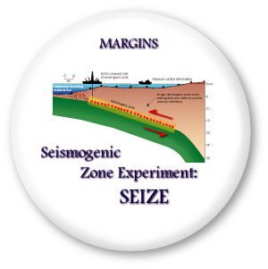
| SEIZE
pages information |
|
What
is the Seismogenic Zone Experiment?
Most
of the world’s great
earthquakes occur in subduction zones. Although plate
tectonics provides the underlying explanation, only
a small portion
of the plate contact generates earthquakes; this portion
is the Seismogenic Zone Initiative (SEIZE). The seismogenic zone
provides both fundamental scientific challenges and
is of great
societal relevance. SEIZE will address the following
questions:
-
What is the nature of strong,
locked parts of seismogenic zones?
-
What are the temporal relationships among stress,
strain, and fluid composition throughout the earthquake
cycle?
-
What controls the up- and down-dip
limits of the seismogenic zone?
-
What is the nature of tsunamigenic
earthquake zone?
-
What is the role of large thrust
earthquakes in mass flux of material in the subduction system?
The Central American and Nankai Trough (Japan)
areas were selected for focussed study by the geoscientific
community
during a
workshop in 1997 (see the SEIZE
science plan for selection
procedure and criteria).
Chile earthquake, February 2010: NSF-IRIS rapid response
SEIZE Nuggets from 2009 Review Documents: Nuggets are available online!
|
|
|
|
| Focus
Areas: |
Central
America |
|
Costa Rica-Nicaragua Focus Area Map |
|
Nankai Trough |
| |
Nankai Focus Area Map |
| Meetings: |
MARGINS-EarthScope Cascadia Amphibious Facility Planning Group, Palisades, NY, 2009 |
| |
The Next Decade of The Seismogenic Zone Experiment. Mt. Hood, Oregon, 2008 |
| |
Subduction Factory and Seismogenic Zone Studies in Central America. Costa Rica, 2007 |
| Meeting pages
contain abstracts, bibliographies, presentations, lecture
notes and much more information. |
Mini-Workshop at AGU 2006 - "Seismogenesis and Subduction Fluxes in the Middle America Subduction Zone: The role of IODP and ORION" |
| SEIZE
2003 Theoretical Institute |
| NanTroSEIZE
Workshop 2002 |
| Seismogenic
Zone Experiment (SEIZE) workshop, Hawaii 1997 |
| Documents: |
SEIZE
Science Plan |
|
NSF-funded SEIZE awards |
|
Cascadia Amphibious Facility Planning Group report (July, 2009) |
| |
Nankai Trough Seismogenic Zone Drilling
and Observatory - IODP Proposal (October 2001) |
| |
Scientific Proceedings from ODP legs 190 and 196 |
| Graphics: |
MARGINS
Presentation materials |
|
Earthquake
maps and cross-sections |
|
Nankai figures |
| Links: |
Don Reed's Virtual Voyage (Nantro-Seize in 3D) |
| |
University of Miami, RSMAS Geodesy Lab |
| |
TUCAN Imaging Proposal - Boston University |
| |
A 3-D Seismic Investigation in the Nankai Trough: US-Japan Collaborative Program |
| |
Improving
Geophysical Observations in Cascadia |
| |
Chile earthquake, February 2010: NSF-IRIS rapid response |
Please feel free to suggest additions to these pages!
E-mail suggestions to the MARGINS Office.
|
|