NSF Program Announcement Research Activities MARGINS-NSF Awards Event Response Policy Data Policy Data Server Post-Doctoral Fellowships Related Websites
|
||||||||||||||||||||
SubFac Focus Site: Izu-Bonin-Mariana
This page is the home for data, figures, references that are relevant to the Subduction Factory Initiative and the IZU Bonin-Mariana focus area. If you have questions, suggestions, or if you want to submit data, please contact the MARGINS Office.

MARGINS Interdisciplinary Mini-Workshop at AGU 2006
MARGINS Interdisciplinary Mini-Workshop on the
Izu-Bonin-Marianas Subduction Factory Focus Site
AGU Fall Meeting, 2006, Mon., 11 Dec., 6-8 pm, Salon A3, San Francisco Marriott
Efforts to reach InterMARGINS and MARGINS-Subduction Factory science objectives in the Izu-Bonin-Mariana focus site have been enhanced by recent NOAA “Submarine Ring of Fire” investigations and the Japan Continental Shelf Project. Geoscientific studies in the region are being further stimulated by a set of IODP preproposals for drilling in the IBM arc system. These complementary efforts can be stimulated in turn by involving the MARGINS Subduction Factory community. This mini-workshop will inform the three communities of these efforts, solicit feedback, and explore possible synergies. The conveners also hope to present the status of a proposal for a future ~3 day MARGINS/IFREE Workshop to Integrate Subduction Factory and IODP Studies in the Izu-Bonin-Marianas Arc System.
Click here for more information about MARGINS at AGU
October 2001: Research Proposal summary, full text available as a PDF file:
U.S.-JAPAN COLLABORATIVE RESEARCH: MULTI-SCALE SEISMIC IMAGING OF THE MARIANA SUBDUCTION FACTORY
Principal Investigators:
B. Taylor, G. Moore, A. Goodliffe, P. Fryer: SOEST U. Hawaii
D. Wiens, G. Smith: Washington U. St. Louis
S. Klemperer: Stanford U. J. Hildebrand: SIO UCSD
K. Suyehiro, S. Kodaira: JAMSTEC
H. Shiobara: ERI U. Tokyo
A. Taira: ORI U. Tokyo
N. Seama: Kobe U.
We propose to carry out marine multi-channel seismic reflection, controlled-source wide-angle reflection/refraction, and passive recording of local and teleseismic earthquakes to provide a comprehensive velocity, attenuation, structural and stratigraphic image of the Mariana island-arc system, from the subducting Pacific Plate to the backarc, at 15° to 18°N. This will be the first completely integrated seismic study of any active arc.
Principal objectives are to determine:
- the velocity and attenuation structure of the mantle as a proxy for temperature/ partial melting of the mantle wedge below the backarc spreading center and the active arc and for hydration and metamorphism below the forearc;
- the large-scale pattern of flow in the mantle wedge, as reflected by seismic anisotropy, which controls the mantle magma supply to the arc and back-arc;
- the precise location and velocity structure of subducting oceanic crust, which will place constraints on the depth of various devolatization/metamorphism reactions and the basalt-eclogite transformation;
- the velocity and density structure of the crust as a proxy for the composition of an intra-oceanic arc, with implications for models of continental growth and crustal recycling to the mantle;
- the seismic stratigraphy and structure of the forearc, arc and remnant arc which, calibrated by existing drill hole data, record a 50 m.y. history of intra-oceanic sedimentation, magmatism and deformation involving subduction initiation, episodic arc volcanism - rifting - back-arc spreading, and serpentinite diapirism. othe possible identification of magma chambers below active volcanoes and of the conduits beneath forearc serpentinite seamounts;
- the possible existence of an intermediate depth double seismic zone and the relationship between slab seismicity and island arc volcanism; othe updip and downdip limits of the seismogenic zone and implications for the largely aseismic subduction in the Mariana convergent margin.
Full proposal text, with figures, as a PDF file (3.6 MB)
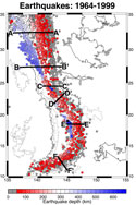
 Izu-Bonin-Mariana earthquake distribution maps and sections. Clicking
on the small map to the left will open a web page with a clickable
map of the earthquake distribution between 1964 and 1999, with cross
sections showing the depth distribution. All maps and cross sections
can be downloaded as high-resolution EPS files from the web page.
The maps are from:
Stern, R.J., M.J. Fouch, and S.L. Klemperer, An overview of the Izu-Bonin-Mariana subduction factory, in press, The Subduction Factory AGU Monograph, 2001.
Please visit Matthew Fouch's web
page or e-mail him for more information.
 P-wave velocity structure of a typical intra-oceanic arc,
measured by detailed OBS studies across the IBM arc at 32° 15' N.
Contours represent lines of constant velocity (C.I. = 0.1 km/s; drawn
thicker at 0.5 km/s intervals). Velocity structure is color-coded (after
Suyehiro et al., 1996). See Fig. below for approximate location.
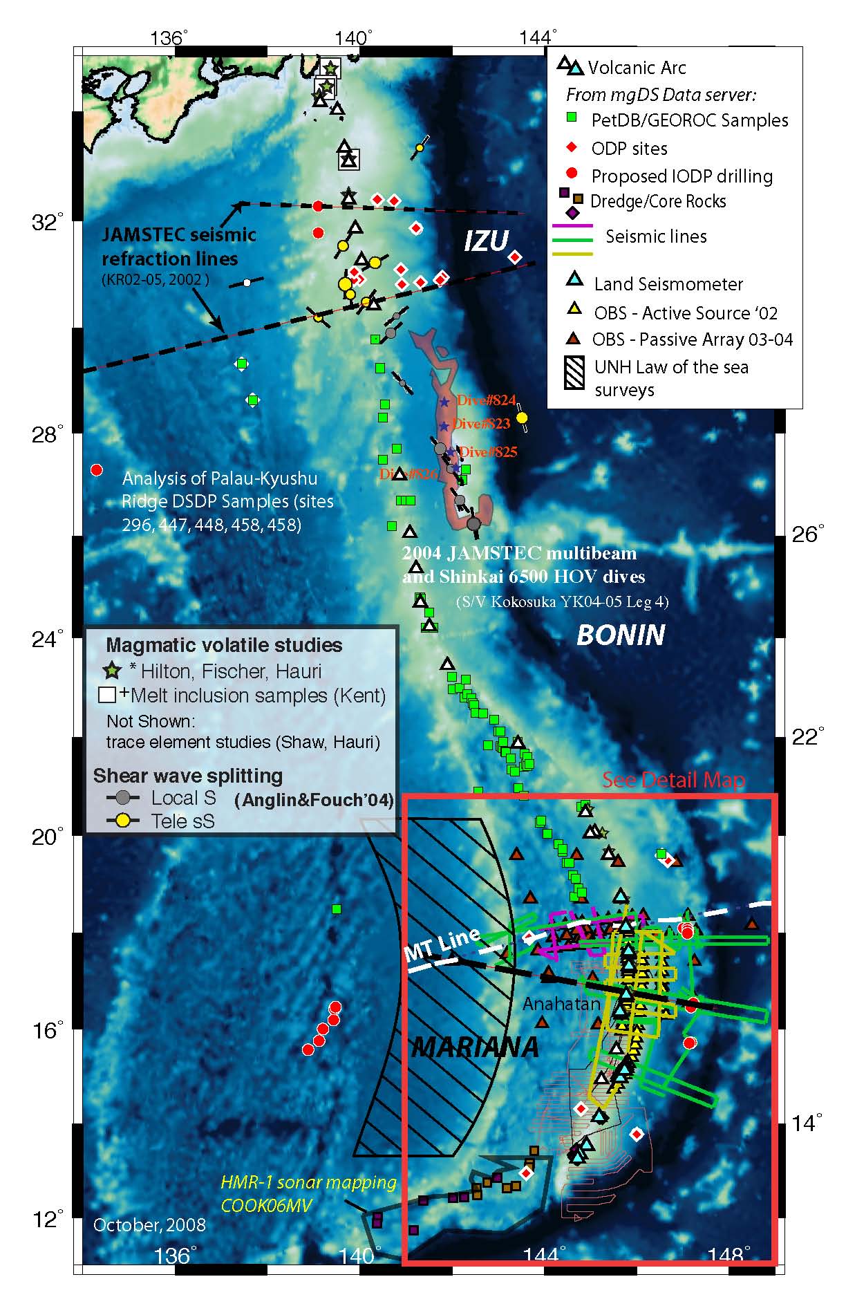
 Locality map for the Izu-Bonin-Mariana arc
system. The IBM arc system shows tremendous variations in tectonic style
and morphologic expression, from collision with Japan in the north to
the greatest deep in the world, the Challenger Deep, in the south. The
Mariana Trough is an actively spreading back-arc basin and the Mariana
forearc contains the only sites of active serpentine diapirism and fluid
egress through a forearc. The detailed crustal section shown in Fig.
above is from the northern part of this arc system.


